Photographing the Laugavegur Trail – The Photographs
14 Apr 2019, Posted by in Blog, iceland, landscapes, laugavegur, Photos, tripsFollowing on from my previous two posts on hiking the Laugavegur trail last year, this post contains my favourite images from that trip. We did the hike back in August 2018 (having started planning in the previous January), so this is clearly a good few months on to only just be sharing images.
That may seem odd, but this trip took a lot of planning and consumed a lot of my thoughts in the months leading up to it so expectations were high, and it can take a while for those expectations to be managed once you get back and offload a few memory cards worth of images. You can obviously never expect to get the ‘perfect weather’ that you hope for. The chances of actually being in the right place at the right time, on a first visit, where you are scoping out locations as you go are very slim. So the reality is often very different to what you spent numerous months imagining. And whilst experience helps you know this before you even set off, it still leads to a challenging period of reflection and objectivity when you look back through the images made. So I’ve spent a little while with these, but it’s about time I stop procrastinating and share them…
I didn’t really get anything interesting from Landmannalaugar, so the first images are from day 1 of the hike, up near Hrafntinnusker. As we started the hike, it was raining and as we were hiking from Landmannalaugar through to Álftavatn in a single day, we decided not to stop to take images with cameras for most of the day – keeping kit dry was a priority and we could have easily spent a lot of time faffing about en route when we had a full day of walking to complete. I was using my phone to take images as we walked, however, and they really do make me wish I’d stopped to take a few ‘proper’ images:
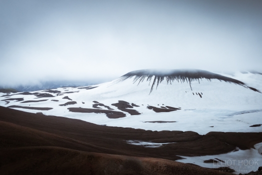
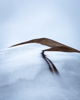
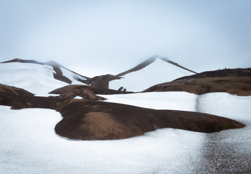
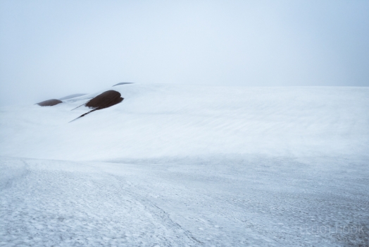
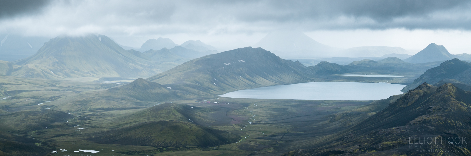
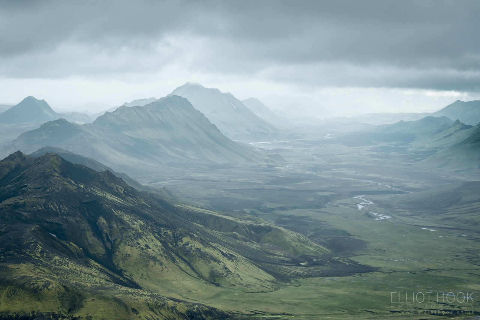
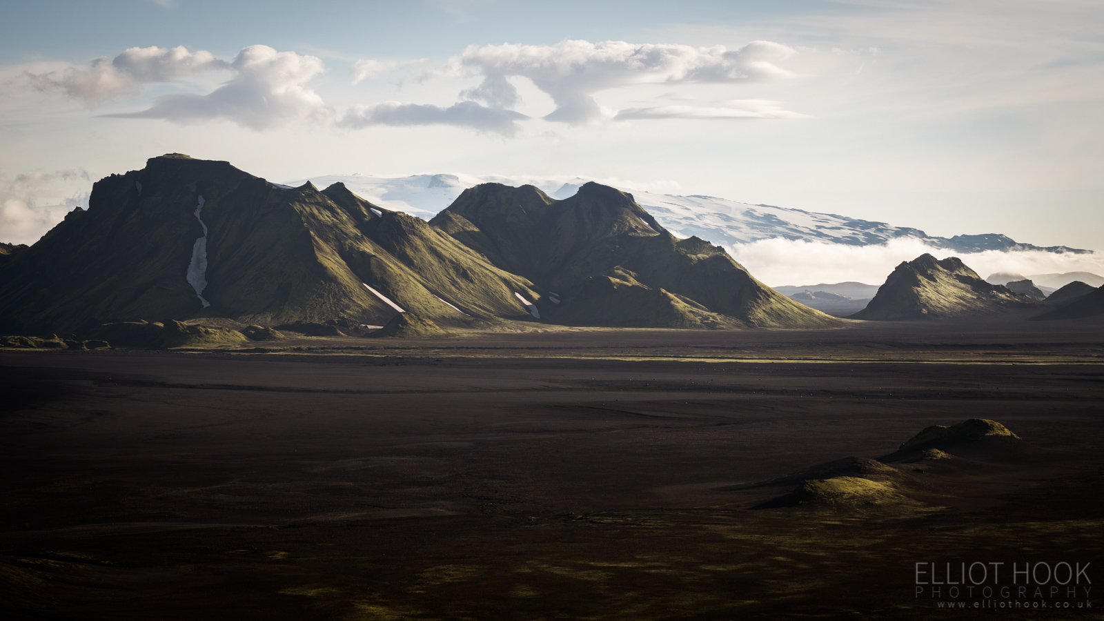
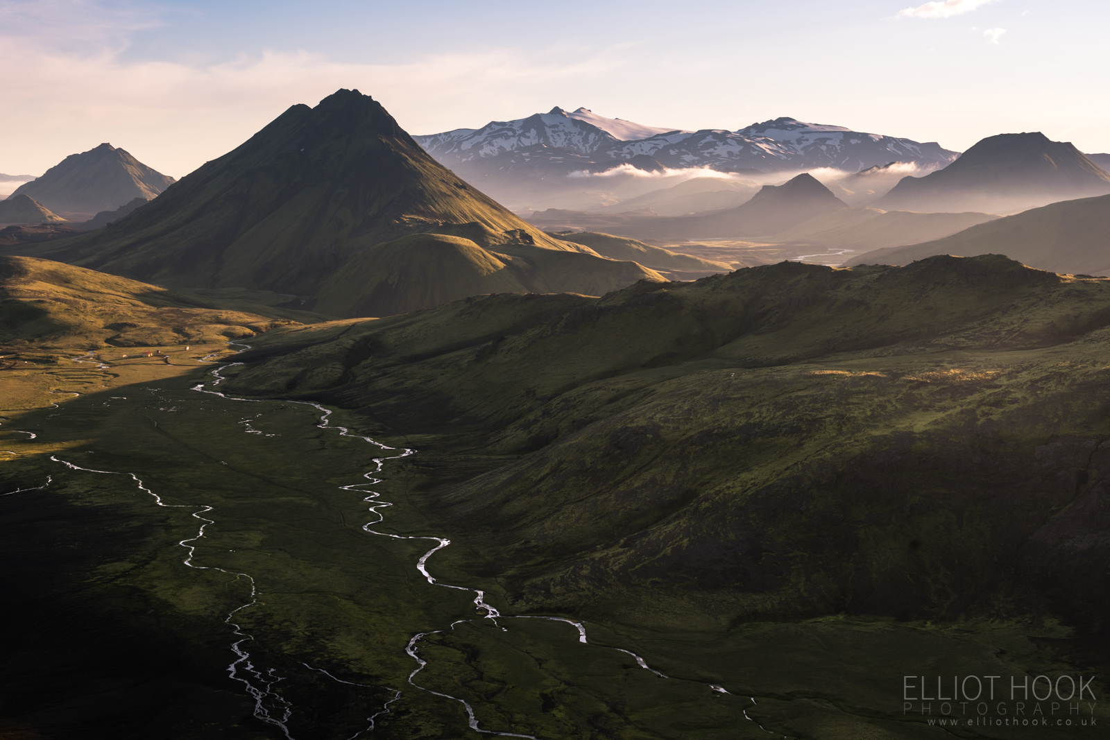
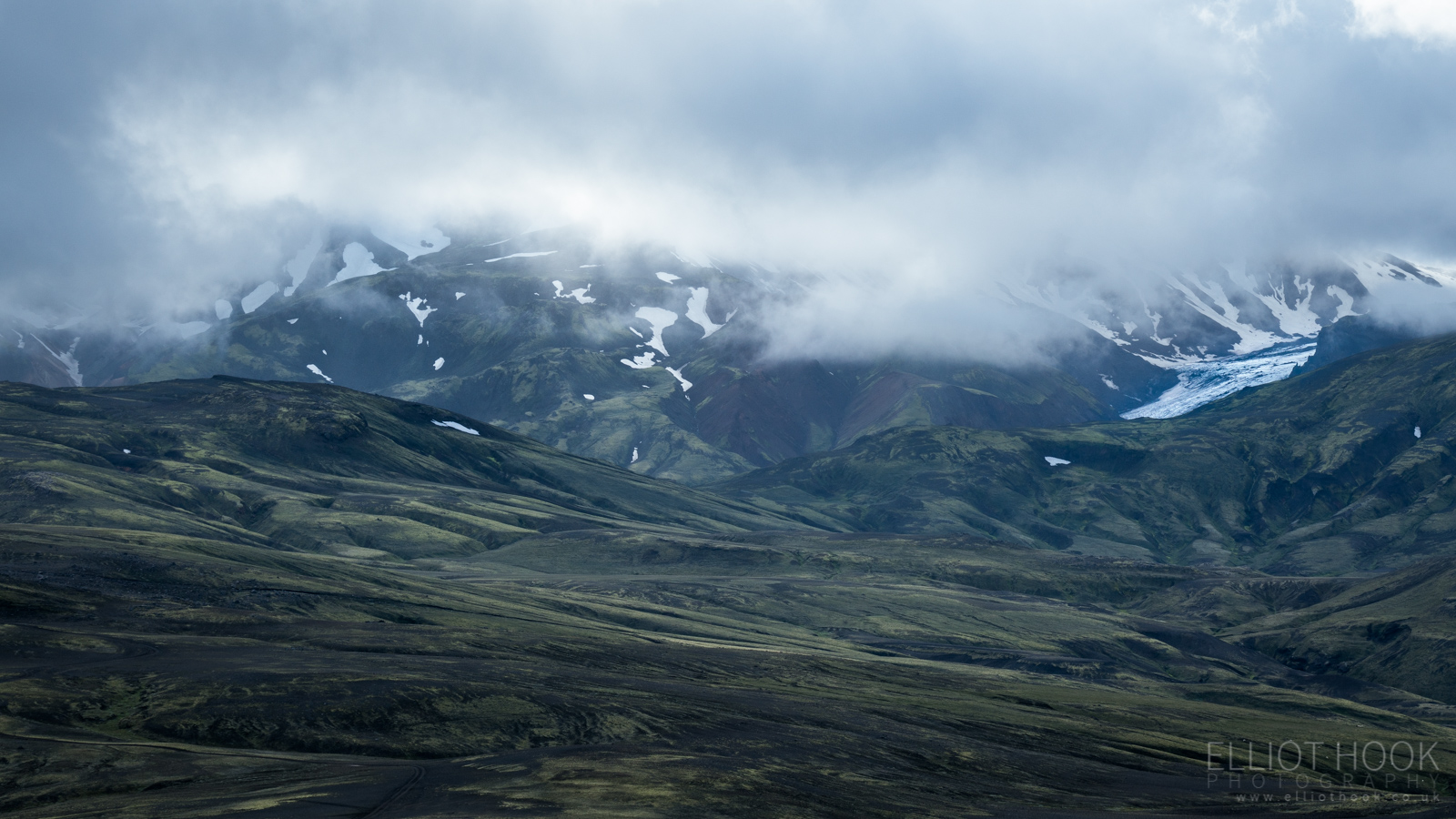
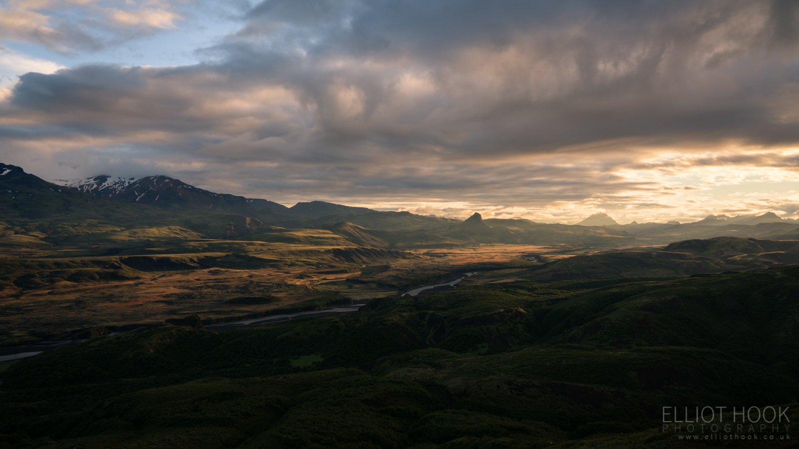
The scenery on that first day was incredible, constantly changing. From geothermal, rhyolite hills out of Landmannalaugar through the snow fields around Hrafntinnusker. But it was when we got to the ridge above Jökultungar that we could see the green and black landscape often associated with this trail stretch out in front of us, including a number of landmarks that were to accompany us over the next couple of days. The panorama below captures the path on to Álftavatn (centre) with Stórasúla, Stórkonufell and Hattfell beyond.
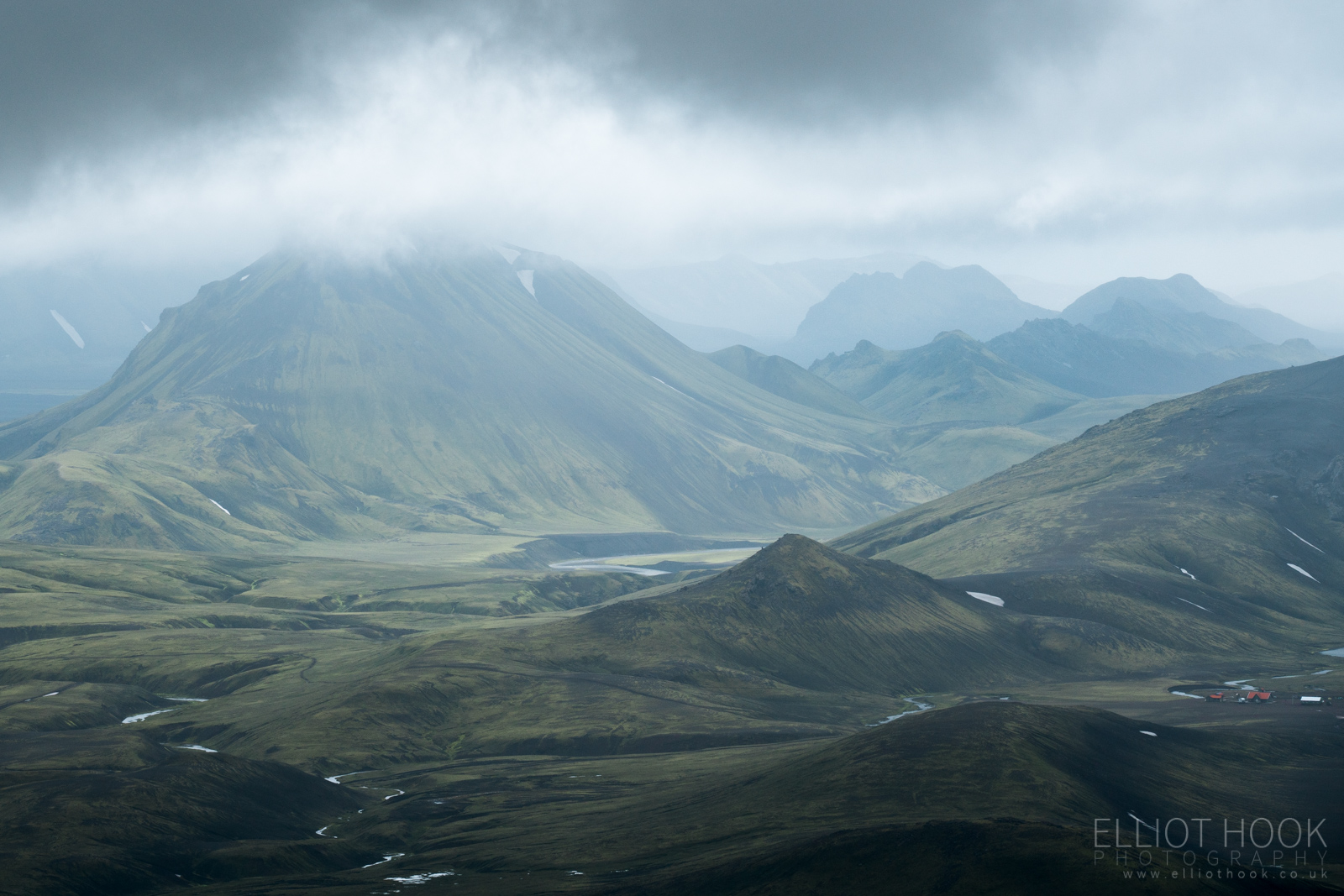
This kind of spot is perfect for isolating interesting portions of the wider landscape with a telephoto lens, so that’s exactly what spent a bit of time doing. First up, is the Álftavatn huts with Stórasúla on the left. Then two shots looking down the Torfakvísl valley.

We really should have stayed here a little longer to see how the light changed but we instead made our descent towards our first river crossing, of Grashagakvísl (below), and on to our hut for the night.
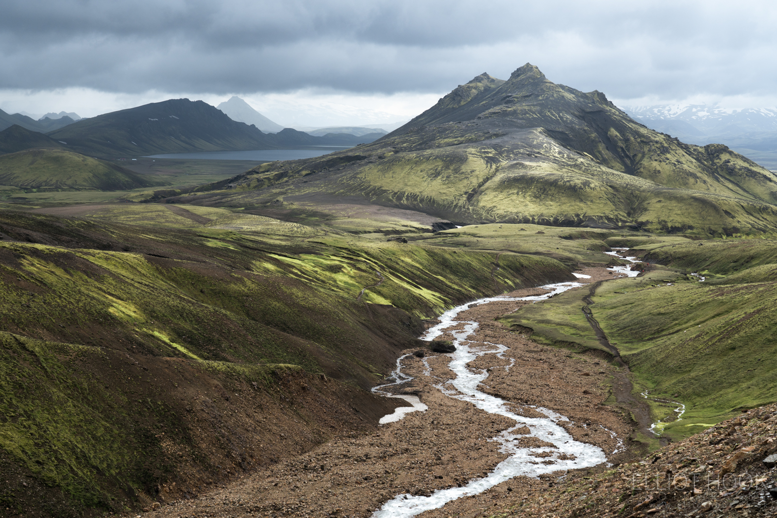
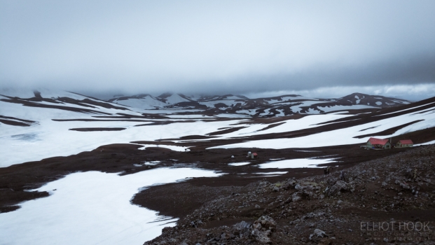
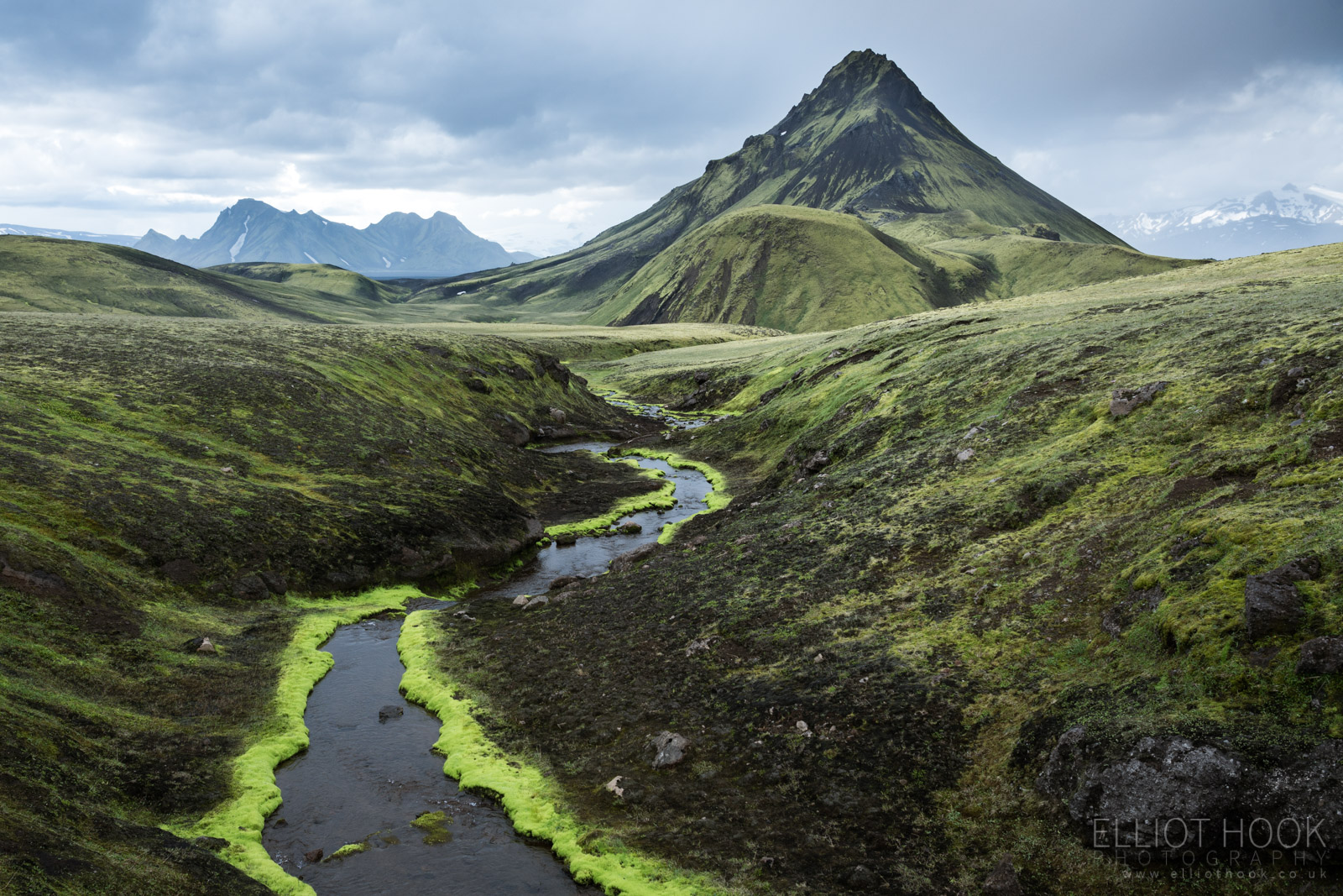
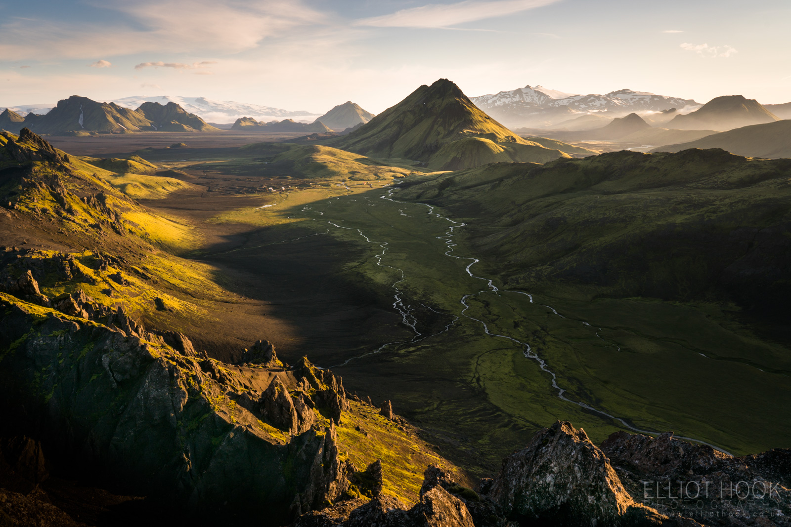
The next day, we only had a short walk to Hvanngil so we could make use of the time and energy to photograph the area. En route to Hvanngil, shortly after another river crossing (Bratthálskvísl), we came across this moss lined stream, flowing towards Stórasúla and couldn’t resist the contrast of the greens giving the natural lead in to Stórasúla and Stórkonufell beyond.
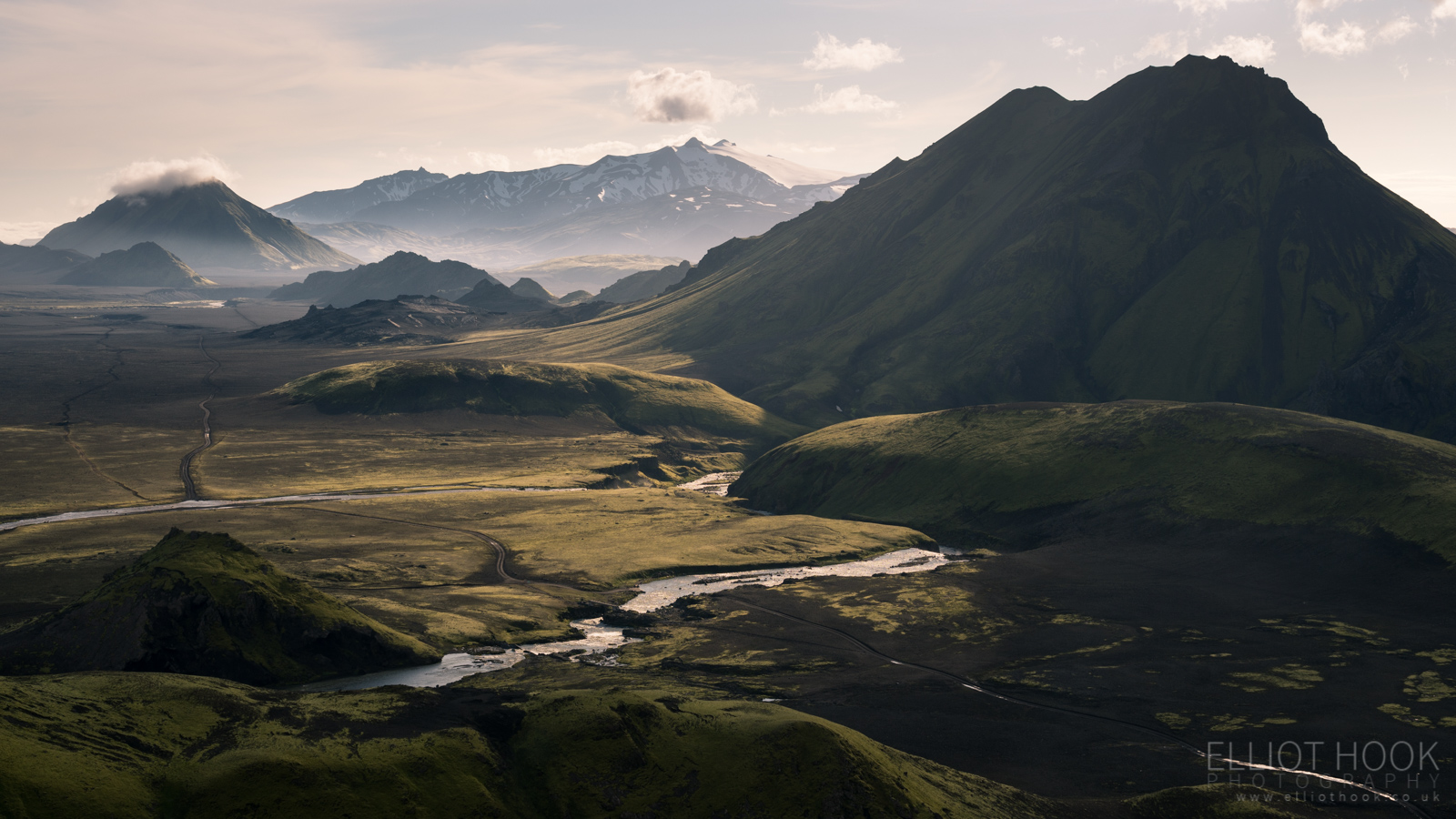
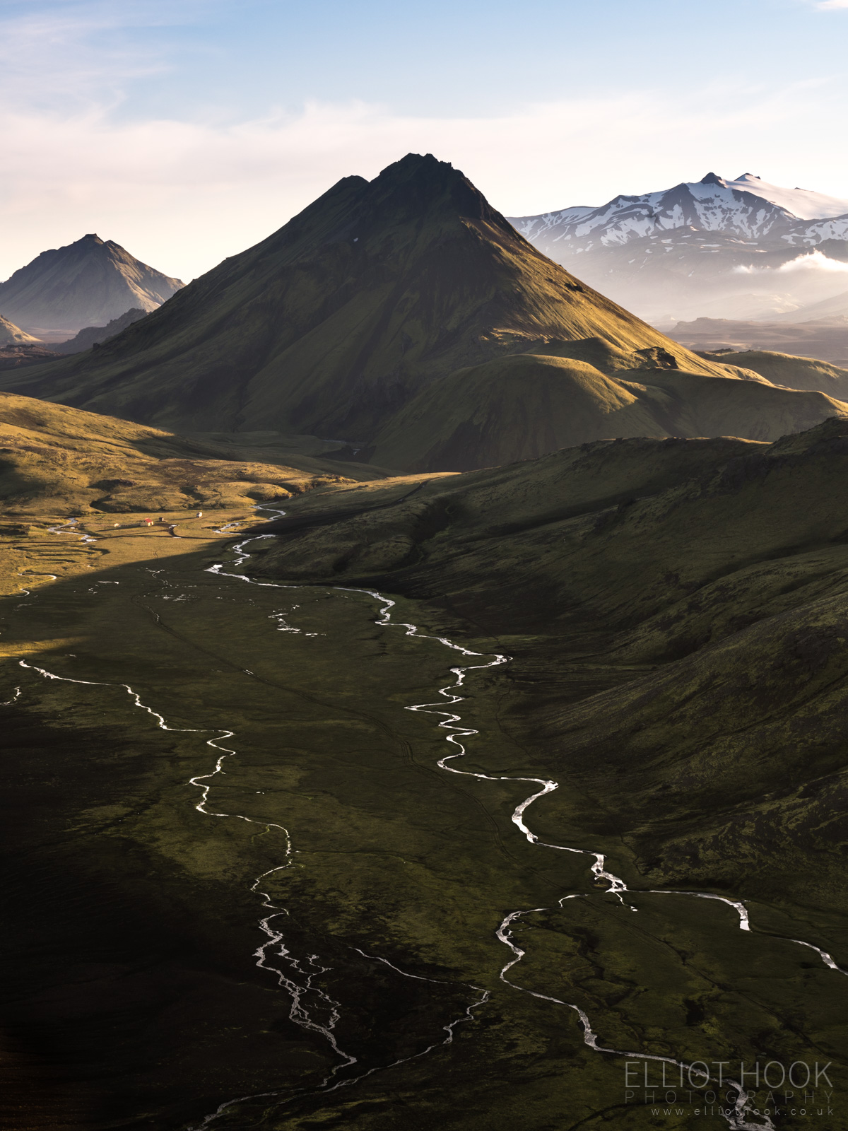
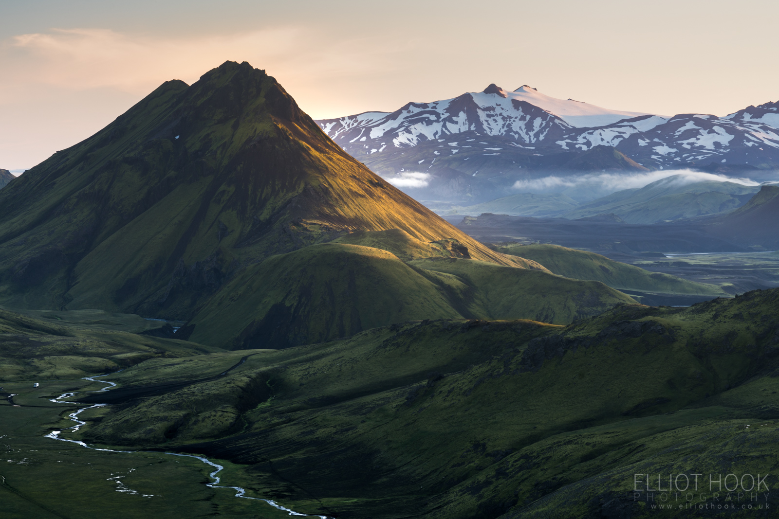
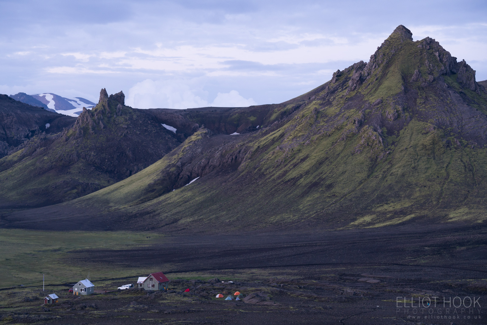
From Hvanngil, a short sharp climb got us to the top of Hvanngilshausar, our location for sunset, giving views of both the “angelic valley”, from which Hvanngil gets its name, and the basalt flats that were to be hiked the following day. On the left, Stórasúla and the Kaldaklofskvísl river with the trail crossing the river by bridge before stretching out over the black desert. On the right, Stórkonufell in the early evening light with the ice cap of Eyjafjallajökull behind.
Followed by some views down the valley of Hvanngil as the sun started set later into the evening.
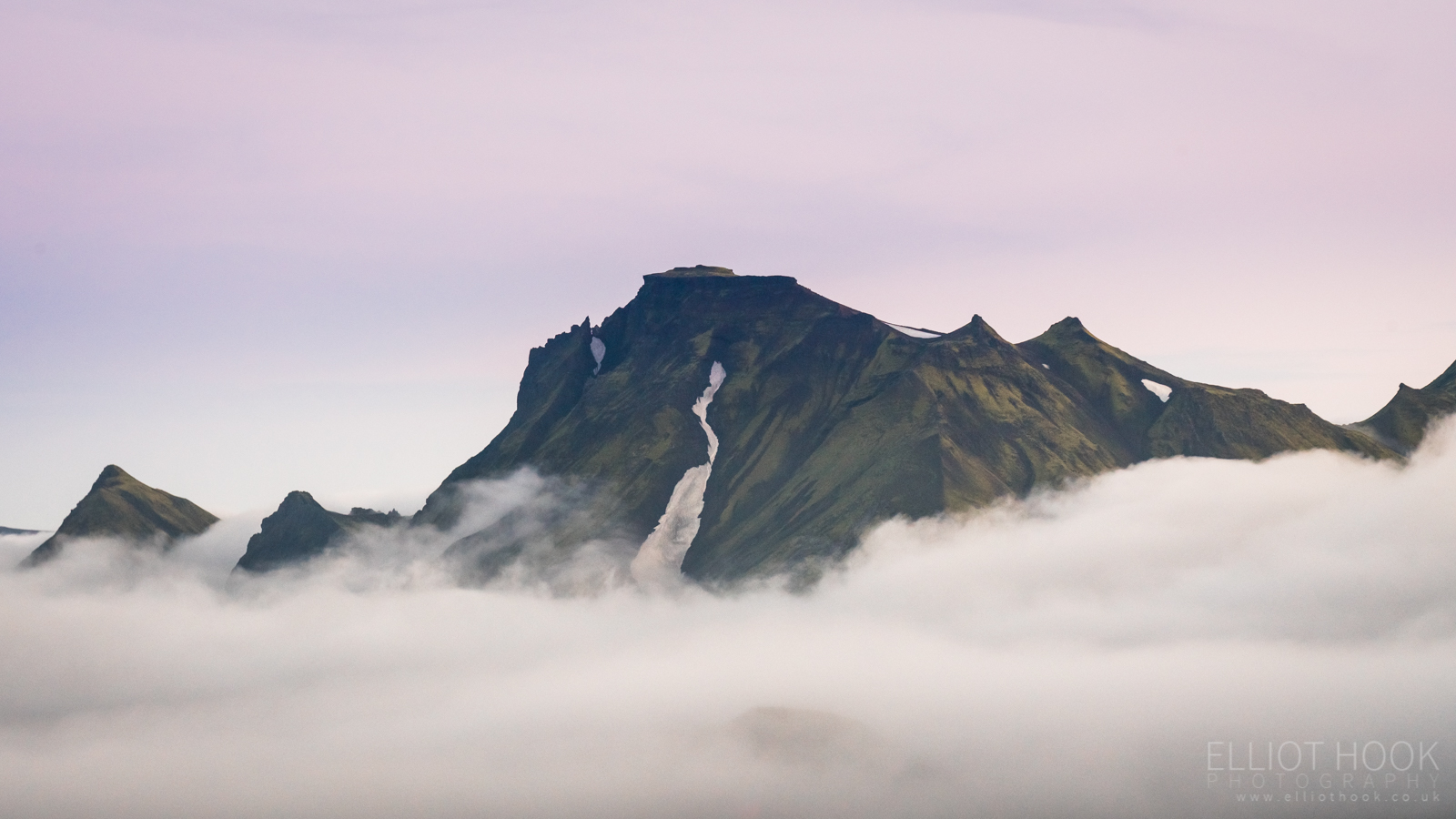
As we started to descend to head back to the hut, the low lying cloud that had been in the background of our photos all evening started to roll across the basalt flats towards us, eventually filling the valley with what must have been a full temperature inversion. We didn’t really make the most of it, but I was able to capture Stórkonufell against a twilight sky, surrounded by clouds…
As well as the huts of Hvanngil, set against the hillside of Hvanngilshausar in soft twilight light…
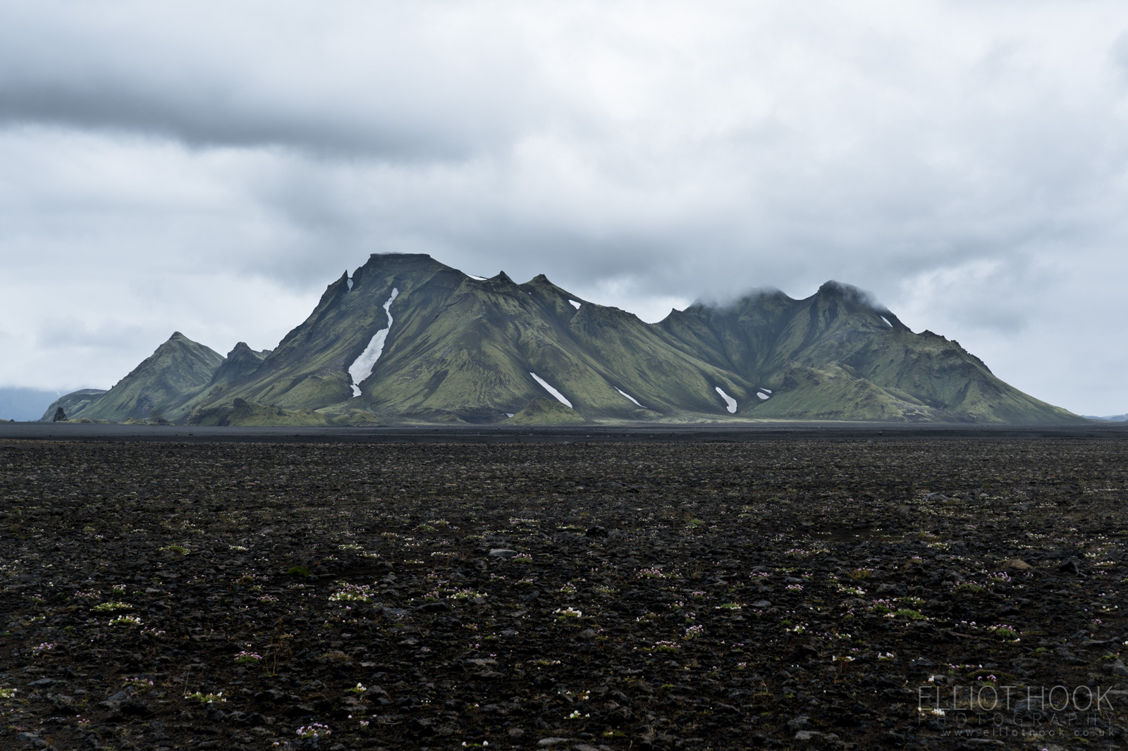
The next day we trekked across the black sands towards Emstrur, with Stórkonufell as our near constant companion. I’d by lying if I said this day didn’t drag, but the scenery didn’t change as quickly as previous days. We didn’t find Emstrur as photographically rewarding as other sections of the hike either, though we take a brief detour to see the Markarfljótsgljúfur Canyon.

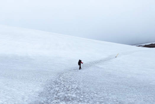
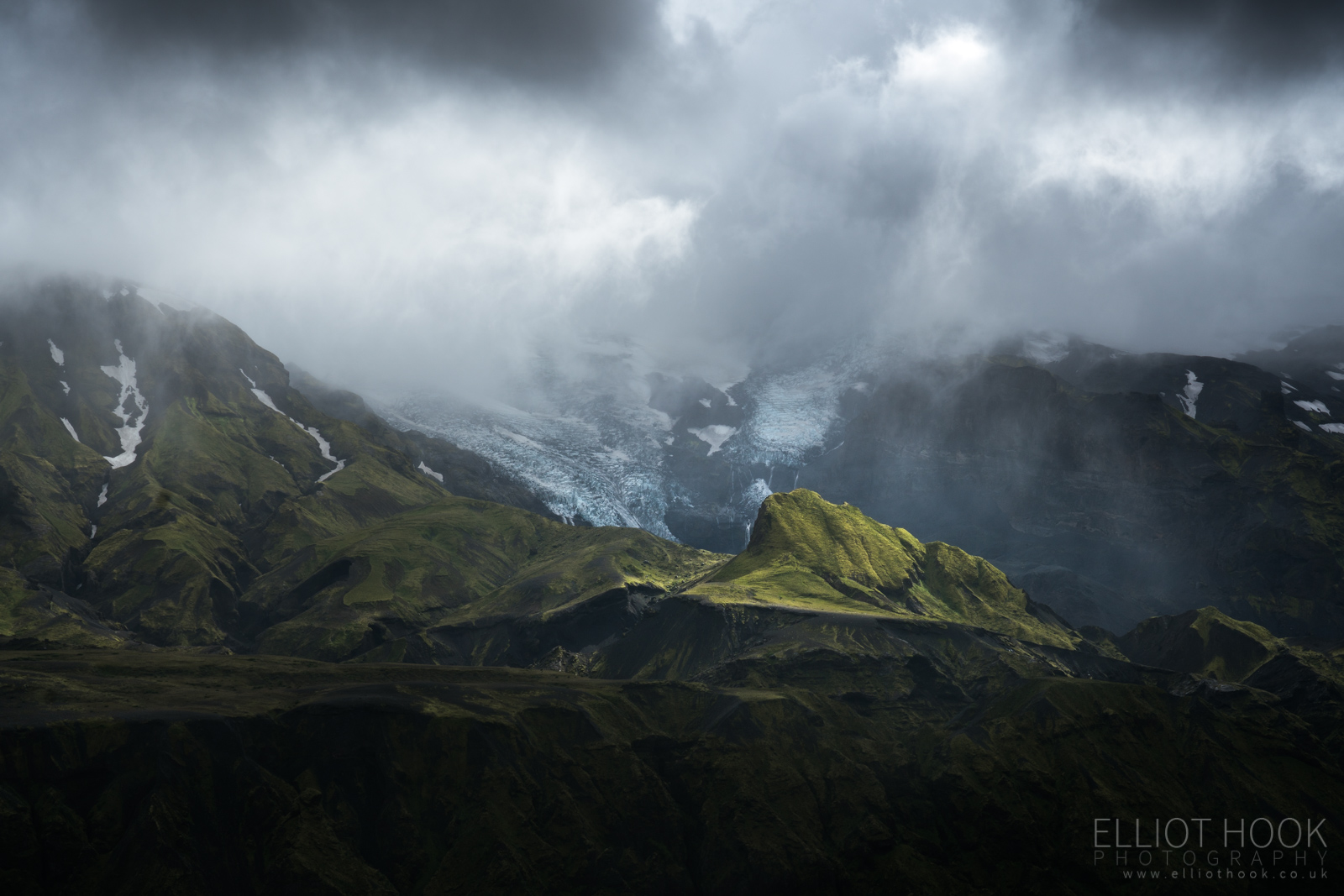
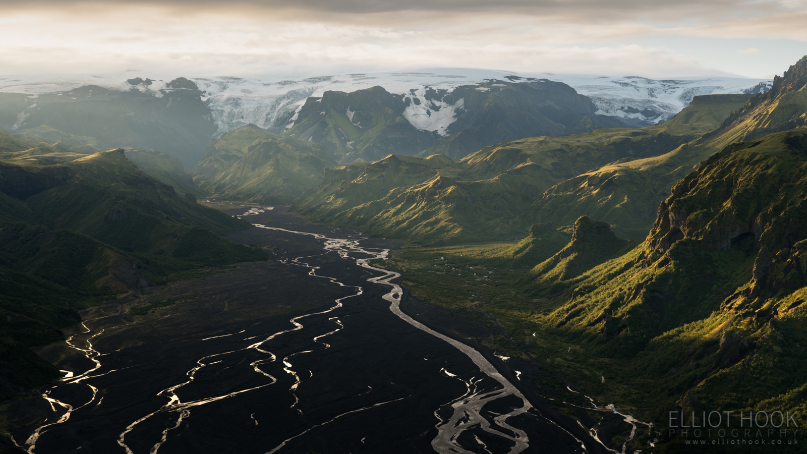
The final day of the hike saw us reach Thórsmörk by mid-afternoon. This final stretch saw the landscape change once more from the black desert through to tree lined hillsides. The weather was suitably moody so we took a trip up Valahnúkur – a peak that gives 360 degree views, looking down multiple valleys with views of glaciers and ice caps. The rolling clouds and bursts of light only added to the atmosphere.
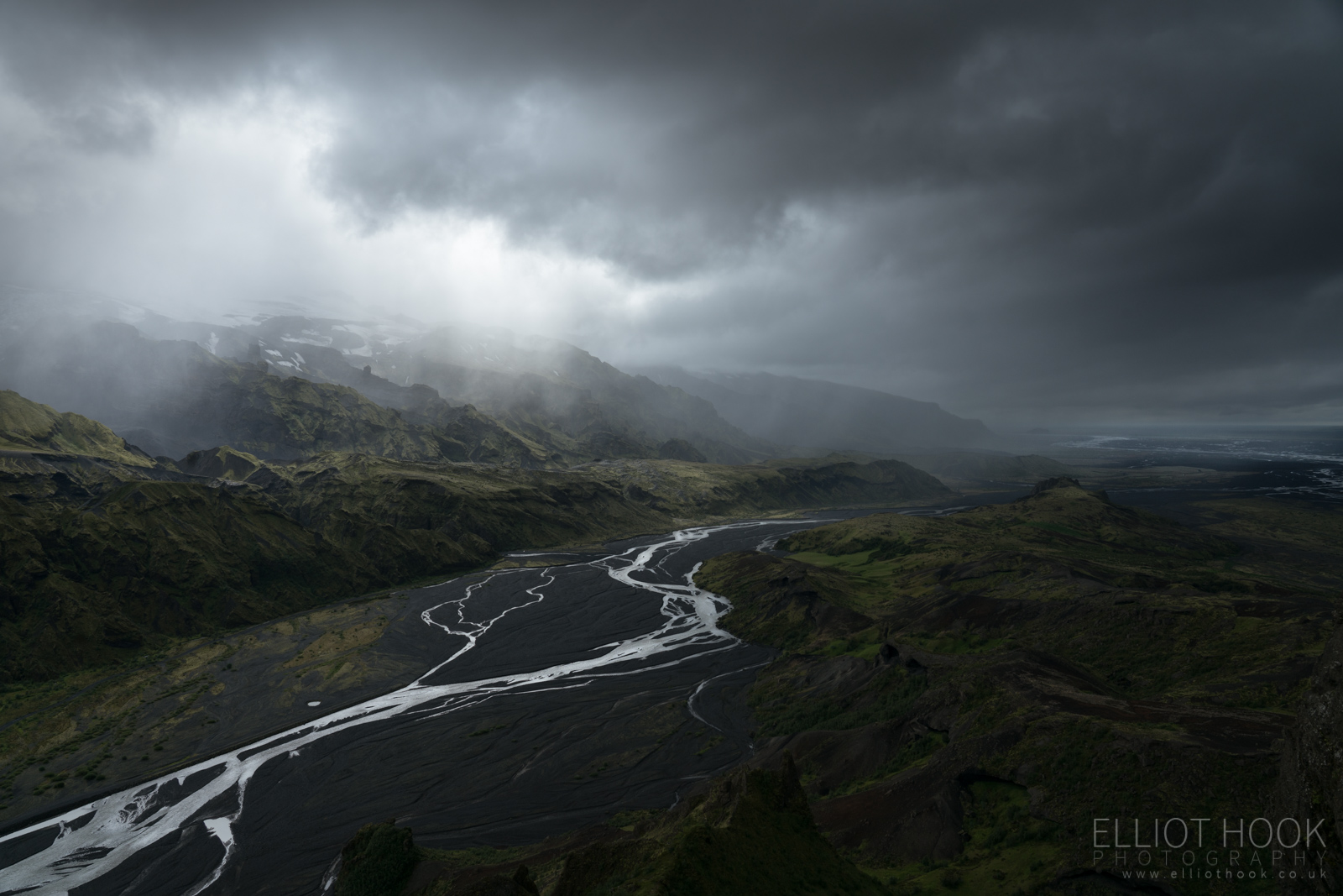
The classic view from Valahnúkur…
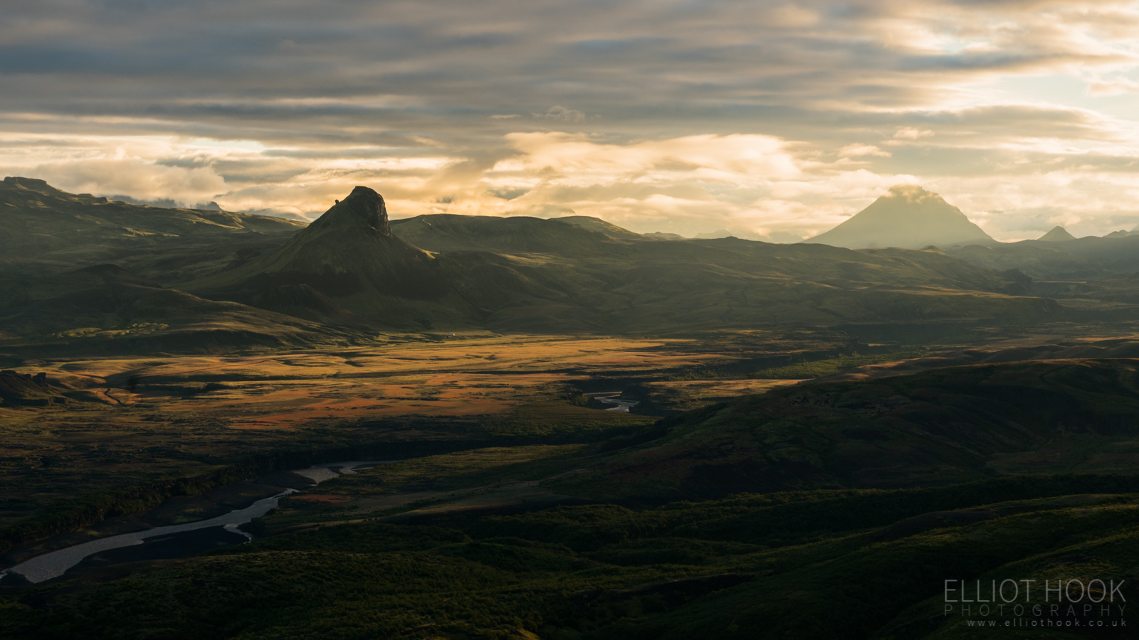
For our final morning, we decided to head back up Valahnúkur in the hope of a sun rise. The early start was worth the effort as we were rewarded with brilliant light looking back towards Hattfell, with Einhyriningur the prominent rock in the mid-ground, on the left.
And the wider view:
The light never really made it in to the valley of Thórsmörk until it was a little later in the morning, but it got there eventually, lighting up the hillside with the Mýrdalsjökull ice cap behind.
That was the final image taken before heading back down to the hut to pack up before catching the bus back into Reykjavík. I think there’s a handful of images amongst those above that I’m really pleased with and, on the whole, I think it’s a reasonable selection to come back with from first trip to such a challenging location (with respect to through-hiking and weather).
This marks the end of the Laugavegur Trail related posts. It was an incredible experience that I would recommend anyone do, especially if keen on landscape photography. I hope these posts prove even vaguely helpful to anyone planning their own trip and if you have any questions about any aspect of the hike, do get in touch via the comments below and I’ll see if I can help.
Also, do make sure you check out George Wheelhouse’s posts and images from our hike too – between the two of us, we should have most aspects thoroughly covered.